Hidden Gems
Creve Coeur Lake Memorial Park
Reporting by Valerie Schremp Hahn. Design and development by Andrew Nguyen.
It’s St. Louis County’s first park, dating to 1945. And at 2,400 acres, it’s the county system’s biggest park. People know it by its namesake, Creve Coeur Lake.
Creve Coeur Lake Memorial Park has a hidden history, and some traces of it still linger: the concrete footings that once supported a watchtower from the 1904 World’s Fair, guns dredged from the lake that dated to the gangsters that lurked there around Prohibition, the Little Creve Coeur Lake that is no longer a lake, but more a marshland that retains water during heavy rain.
Jim Gerken, the park’s operations manager, and Mike Hodges, district manager of the West County St. Louis County parks, gave the Post-Dispatch a tour, showing off the park’s hidden and not-so-hidden highlights.
Location #1
Greensfelder Shelter

Photo by Hillary Levin / St. Louis Post-Dispatch
St. Louis city residents and denizens are familiar with the Starbucks and Chipotle housed in the midcentury “flying saucer” building on South Grand Boulevard. Creve Coeur Lake Memorial Park has its own saucer. Greensfelder Shelter was built in 1956, and a bas relief sculpture in its stone base says it was named after Albert P. Greensfelder, the first chairman of the St. Louis County Parks Advisory Board. It also offers a sweeping view of Creve Coeur Lake, the Page Avenue bridge and Theiss Farms in the bottomlands. Gerken points out that if you were looking down from this spot years ago, you could see the two lakes — one since dried up — that formed a broken heart shape, where he believes the name Creve Coeur comes from. The shelter has three fireplaces in its base and is heavily used, he said. “From a picnic and party point of view, you have a playground, a nice background and a bathroom,” he said.
Location #2
Dripping Springs

Photo by Hillary Levin / St. Louis Post-Dispatch
At the edge of a parking lot on the southeast part of Creve Coeur Lake you’ll find a small stone bridge overlooking dripping springs. A nearby wooden sign spins a tale of the lake’s namesake. “Scene of the tragic death of the lovelorn Indian girl whose broken heart is said to have given the lake its sorrowful name, "Creve Coeur," says the sign. “Don’t believe everything you read in the paper,” Gerken quipped. Still, the water rushes over the rock cliff after a heavy rainfall, and makes for an impressive frozen display in the winter. The unpaved Mallard Lake Loop trail, which runs alongside the cliffs, also runs along a couple more rock formations that drip with water after heavier rains. Keep your eye out for a Jeep carcass, thought to be abandoned during a mudding jaunt in the 1970s or '80s. The trail is built on the old Missouri Pacific railroad line, and the Polar Wave Ice Company used to cut ice from the lake, pack the blocks in sawdust, and put them on the trains.
Location #3
Hopewell Indian settlement

Photo by Hillary Levin / St. Louis Post-Dispatch
Near the Branwood Corporate Picnic site and ballfields, likely the site of more than one awkward ballgame with the bosses, was the site of a Hopewell Indian settlement dating from about 1,200 years ago. Shards of pottery found here in the 1930s led to more formal excavations in the following decades. “It’s the largest natural lake in the state,” said Gerken. “Why wouldn’t it be a draw for Indians?”
Location #4
Streetcar power substation

Photo by Hillary Levin / St. Louis Post-Dispatch
Turn into the park off Dorsett Road to Streetcar Drive, and you won’t be surprised when that road leads to a brick building dating to 1899, once used as a power substation for the streetcars. It’s now used by Go Ape!, a zipline operator. The streetcar line started at Delmar Boulevard and Kingsland Avenue, known as the Delmar Loop, and traveled along Midland Avenue, eventually making its way to Creve Coeur. The drive still loops near the building, following the route of the streetcar line. At the top of the loop and a short walk into the woods you can spot concrete pads on the ground. These were the base of the old DeForest lookout tower, which was first built at Niagara Falls and stood in Forest Park during the 1904 World’s Fair, serving as a wireless telegraph tower. The area was also once home to an amusement park, called Electric Park.
Location #5
Concrete staircase

Photo by Hillary Levin / St. Louis Post-Dispatch
People familiar with the park know about the concrete stairs — all 219 of them — leading from the streetcar loop area of the park through the woods down to the lake. While they’re commonly used for exercise, they were once used by people getting off the streetcar for a leisurely visit to the lake below. The lakeside used to be home to several cottages, dance pavilions, hotels and saloons, which attracted seedier characters and gangsters during Prohibition. During a dredge of the lake in the early 2000s, workers found guns in the water that likely dated from that time, said Hodges.
Location #6
1,000 acre acquisition

Photo by Hillary Levin / St. Louis Post-Dispatch
In 1999, Creve Coeur Lake Memorial Park got an extra 1,000 acres of land as part of a deal to give up 25 acres for the Page Avenue Extension. The extra land, on the west side of the park, includes trails that meander through wetlands, prairie and taller trees that have grown from saplings. Gerken thinks the trade was a good deal. “This is an unknown gem, in my opinion,” said Gerken. “Not ballfields, not shelters, not ice arenas, but nature.”
Location #7
Mallard Lake
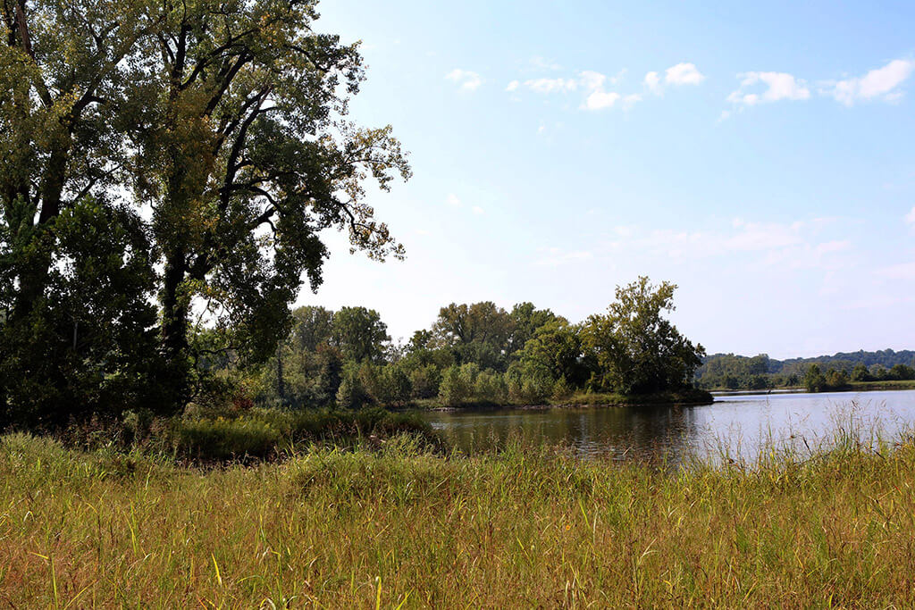
Photo by Hillary Levin / St. Louis Post-Dispatch
Also as part of the Page extension project, Mallard Lake, about 75 acres, was created to catch silt before it flowed into the larger Creve Coeur Lake. People regularly fish the lake and a new Lou Fusz Soccer Complex, completed earlier this year, sits near the lake. The imprint of an old dog racing track was still visible in the land before the soccer complex was built.
1
2
3
4
5
6
7